Antarctica like you've never seen it before
Many months ago, we were approached about helping start up LocalWiki in Antarctica.
In.
Antarctica.
Antarctica!
The project, sponsored by the Open Antarctica organization, would aim to initially document a region of roughly 2 miles surrounding the Palmer Station United States base on the Antarctic Peninsula.
Our first question was: wait, there's Internet in Antarctica? And yes, there is Internet access on the Antarctic bases — access that's provided over an awesome looking, though incredibly slow, satellite uplink. So slow, in fact, that we briefly thought about sending our contact down to Antarctica with a plug-in computer running a little LocalWiki server — but ultimately decided it was too much work for little gain.
The next thing we started thinking about was mapping. Maps are a core feature of LocalWiki, so having a good map of the area, particularly the area near the research station, was really important. And ideally we'd have some aerial imagery and not just a vector map. "Let's take a look at some maps of the area!" we thought.
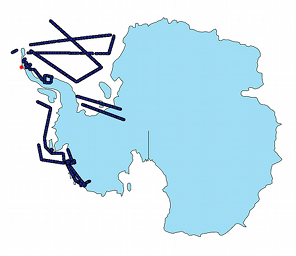
Given that we use OpenStreetMap data in our default base layer, let's check out what our OpenStreetMap-based tiles look like around the island containing the research station:
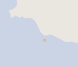 The orange dot is where the station is.
As you can see, the OpenStreetMap map doesn't really show any of the detail here — it's missing the whole peninsula the station is on! The story's the same with most freely-licensed satellite imagery:
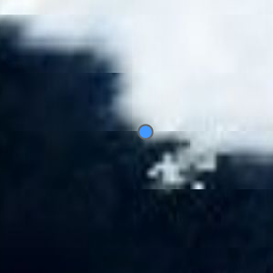 Typical freely-licensed satellite imagery.
Some commercial satellite imagery, like Google's, is better, but it's still not at the level of detail we wanted — and it's not freely licensed. There's got to be some good aerial imagery of this region out there, right? Maybe if I we found some good imagery we could stitch it together into a map?
Then we found this amazing NASA Photo of the Day:
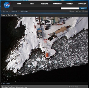
OH MY GOD! That's just incredible detail and quality! Hope!
Making the map
Searching through the USGS Earth Explorer didn't turn up anything near the quality of this NASA photo of the day image. Hunting around different NASA websites didn't seem to give many clues, either. The best clue was the photo caption from the Photo of the Day, which read:
[...] greeting to scientists and flight crew aboard NASA's DC-8 flying science laboratory as it flew over the station during Operation Ice Bridge.
After even more digging around, I stumbled upon the FTP site where NASA was hosting Operation Ice Bridge images. Presumably, the image from the NASA Photo of the Day would be in there — and hopefully a bunch of great shots of the surrounding area. The only problem was that the FTP site had many, many directories, each with thousands of files:
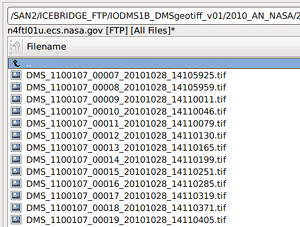
I experimented with downloading a few random images and plotting them in QGIS, but it quickly became clear that downloading all of the hundreds of thousands of images and plotting them using this way just wasn't going to work — there were too many images, we didn't have the many, many terabytes of required space, and the GeoTIFFs quickly overloaded QGIS. Alex Mandel recommended trying to find a pattern in the filenames — but after working on the problem for a bit we didn't seem to get anywhere.
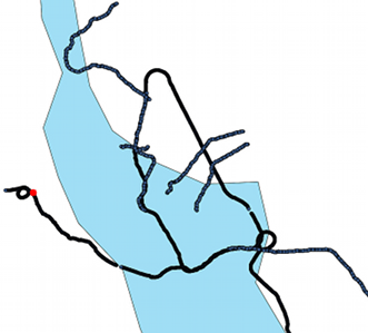
So we ended up writing a little FTP client to grab just the few Kb of each file, which ended up being enough to get the location metadata out of the GeoTIFFs. With that, we could easily import the location of every image:
...and then start plotting them on a map, revealing airplane's flight path:
 The red dot is the research station.
Getting there... after plotting a few hundred thousand other data points:
 The red dot is the research station.
Sweet! It looks like there's quite a few images around the station! So there's some hope we can piece together a great aerial map of the region.
Overview / vector map
So, there's hope we'll pull off an aerial map of the region. But it's going to be pretty spotty — the NASA Ice Bridge project is set up to just snap photos of the coastlines, basically. We'll have to lay the aerial imagery on top of something. And because the project may later want to cover other regions in Antarctica, we'd like to have a good base map of the whole continent.
But the problem is that standard maps are designed to make most of earth look right when flattened out, always at the expense of Antarctica. Which usually makes a lot of sense.
 Antarctica, viewed on Google Maps. (© Google)
Paths around the South Pole would look really wonky with this standard projection. Fortunately, there's a better projection for Antartica. After much fiddling with Geoserver, we figured out how to get it to correctly reproject vector data in this esoteric projection.
So, we can reproject vector data into this fancy Antarctic projection, but where can we get decent vector data of Antarctica? As explained earlier, the OpenStreetMap data isn't very detailed. Thankfully, the fantastic Antarctica Digital Database comes to the rescue! They have highly-detailed coastline data of the entire continent that's freely usable for non-commercial purposes.
 The zoomed-out-all-the-way map in all of its stereographic glory!
Stitching together aerial imagery
So, we've got all these images from the region around the station, but how do we stitch them together into a map we can serve and suck into OpenLayers?
Figuring out how to serve individual GeoTIFF files was pretty easy. The problem was figuring out how to stitch all of these images together. We tried out several of the Geoserver-specific approaches to image stitching, but none of them worked. The Image Pyramid plugin seemed to crash when using this Antarctic projection — and the same sort of crash happened when trying to import a VRT file of all the GeoTIFFs and when using the Mosaic feature of Geoserver.
Maybe we can just stitch the GeoTIFFs together ourselves, somehow? First, we tried using gdalwarp to do the stitching:
 Area near the airport the plane took off from.
...which worked, but there are weird black lines in the image, what are those? Turns out the images, while TIFFs, were compressed internally using JPEG compression and we need to run the nearblack utility on them before stitching.
So, we threw together a script to clean up the images and continually stitch them together using gdalwarp. All done? Not so fast. The images, when uncompressed, balloon to around 2GB or so each — EC2 to the rescue! We spun up a server with an insane amount of disk and ran the stitch script for several days, taking a look at the output and tweaking it throughout.
This left us with one stitched-together, compressed GeoTIFF that weighs in at slightly less than 2GB. After building overviews for various zoom levels into the GeoTIFF, it was relatively easy to load it into GeoServer as a raster storage source and then combine it with the vector data layer. The aerial and vector layers didn't quite line up, but after fiddling a bit with the projection we got them be as aligned as could be expected.
The result
After much tweaking and dealing with strange errors — almost all of which related to map projection issues — we finally put together a beautiful map of Antarctica in a glorious stereographic projection with stunning aerial imagery of the region laid on top of it:
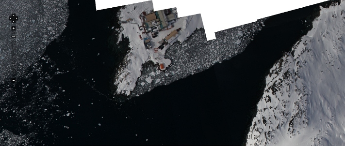 The area around Palmer Station. View map.
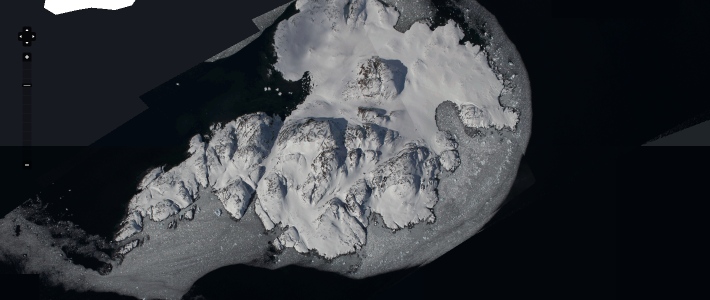 Litchfield Island, the "island most frequently seen in dreams." View map.
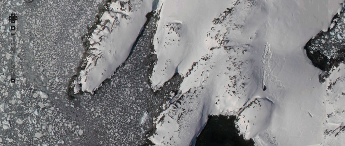 Shortcut Island. You can even spot a seal! View map, view page.
Some beautiful pages
You should explore the project! Here's some beautiful pages to take a look at:
- Breaker Island
- Christine Island
- Hot Tub in Antarctica!
- Humble Island
- Shortcut Island
- Earth Station
- Wauwerman Islands
- Trolley
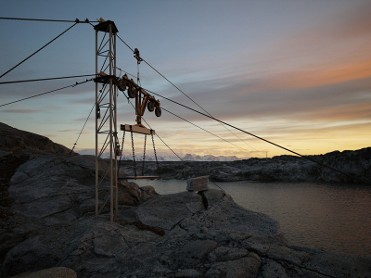 The station trolley.
An API for your city
We're excited to announce that the first version of the LocalWiki API has just been released!
What's this mean?
In June, folks in Raleigh held their annual CityCamp event. CityCamp is a sort of "civic hackathon" for Raleigh. During one part of the event people broke up into teams and came up with projects that used technology to help solve local, civic needs.
What did almost every project pitched at CityCamp have in common? "Almost every final CityCamp idea had incorporated a stream of content from Triangle LocalWiki," said CityCamp and Triangle LocalWiki organizer Reid Serozi.
The LocalWiki API makes it really easy for people to build applications and systems that push and pull information from LocalWiki. In fact, the API has already been integrated into a few applications:
-
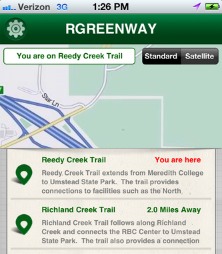
The winning project at CityCamp Raleigh, RGreenway is a mobile app that helps residents find local greenways. They plan to push/pull data from the Triangle LocalWiki's extensive listing of greenways.
-
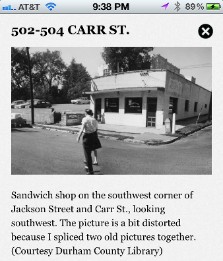
Another group in the Raleigh-Durham area, Wanderful, is developing a mobile application that teaches residents about their local history as they wander through town. They're using the LocalWiki API to pull pages and maps from the Triangle LocalWiki.
Ultimately, we hope that LocalWiki can be thought of as an API for the city itself. A bridge between local data and local knowledge. Between the quantitative and the qualitative aspects of community life.
Using the API
You can read the API documentation to learn about the new API. You'll also want to make sure you check out some of the API examples to get a feel for things.
We did a lot of work to integrate advanced geospatial support into the API, extending the underlying API library we were using — and now everyone using it can effortlessly create an awesome geospatially-aware API.
This is just the first version of the API and there's a lot more we want to do! As we add more structured data to LocalWiki the API will get more and more useful. And we hope to simplify and streamline the API as we see real-world usage.
CityCamp photo courtesty CityCamp Raleigh
July awesomeness!
We want to let you know about some really fantastic stuff that's been happening in the LocalWiki world over the past month!
Tallahassee, Florida
The folks spearheading LocalWiki in Tallahassee held their first two in-person CampWiki workshops. The idea behind the workshops is to introduce community members to LocalWiki, get them excited, answer questions and start building out the project.
Their meetup even made the front page of the Tallahassee Democrat!
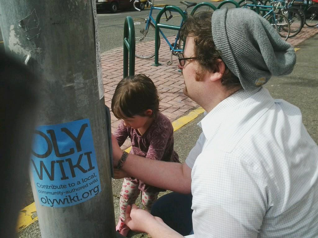
Olympia, Washington
Olympia held its first little in-person LocalWiki meetup. Unfortunately, they didn't take any pictures, so here's a photo of Seth Vincent, the project leader, putting up some flyers around town!
Oakland, California
A group of really great folks have started laying the groundwork for LocalWiki in Oakland, and during the Code for Oakland hackathon on Saturday there were around 30 people digging into Oakland LocalWiki. The group was so large that it was broken into two rooms, one for helping with development / tech stuff and the other for content and planning!

Raleigh, North Carolina
The Raleigh City Council has begun to investigate how to, in its official capacity, best work with the Triangle LocalWiki project! Here's a clip from their recent City Council meeting where Councilmember Gaylord asks city staff to come up with a report on how to collaborate with the project:
Tokyo area, Japan
Thanks to the internationalization work done by Pedro Lima and Nuno Maltez in Portugal, there's been an increasing amount of international interest in LocalWiki. A couple of weeks ago, Shu Higashi gave a demo of LocalWiki to a group of Open Data activists in Japan. The best part? He demo'ed his Japanese translation of LocalWiki!
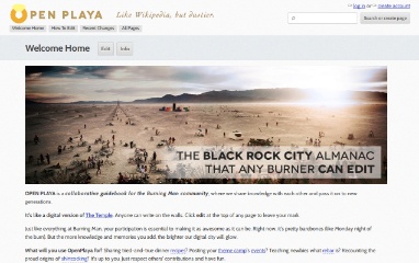
Black Rock City (Burning Man)
Some folks are starting up LocalWiki in Black Rock City / Burning Man! It's literally just getting started, but it's such a cool idea we wanted to share it with you!
LocalWiki Organizers mailing list
Organizing a new LocalWiki project or wanting to get started? You should join the ultra-new LocalWiki-organizers mailing list! Be sure to send a little introduction to the list after you've joined!
Miscellaneous awesomeness
In no particular order, a few other interesting things that've happened over the past month:
 Philip giving a talk at the annual Wikipedia conference
- Code for America made a blog post which made the case that "open data platforms and local wikis are foundational elements..of civic life."
- Philip gave a talk on LocalWiki at the big Wikipedia conference in DC last week. Lots of excitement & interest!
- TriangleWiki and LocalWiki got a shoutout in the Columbia Journalism Review: Building a multi-platform media for—and by—the public.
Tallahassee photos courtesty Bob Howard. Oakland photos courtesy Eddie Tejeda.
The most important part of building LocalWiki: having fun!
LocalWiki is all about community, and we believe that starts with people coming together and having fun. Here are a couple of recent examples of ordinary people hanging out, having fun and building out LocalWiki!
San Francisco parklet ride
A couple weeks ago we were slated to have an absolutely beautiful weekend here in SF, and I thought, "you know, it's gonna be a beautiful weekend — it'd be great if we could just bike around, take pictures, enjoy the beautiful day, and toward the end of the day get on our laptops and work on the soon-to-be-launched SF LocalWiki project!"
So I just threw up a Facebook event, invited some friends and came up with a little came up with a little plan: document all the parklets we encountered on our bike ride through the city.
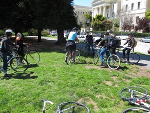
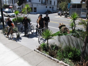
And we did just that! We biked around, had lots of coffee, ate some delicious baked goods, and took pictures of a few parklets we encountered. We randomly encountered one of the parklet's primary designers and even found a parklet that features a totally awesome beanbag seats and pacman!
At the end of the day we'd made a few pages on LocalWiki, but more importantly, we shared a fun experience together!
Kitchener LocalWiki Workshop
This is Steve:
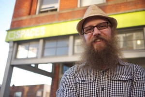
Steve's an artist who does really amazing projects like SelfControl, AddArt, and Capitalism Works For Me! True/False.
Last week, Steve got together with CAFKA, a public space art organization, and held a two-evening workshop for artists and residents in Kitchener, Ontario on building LocalWiki in Kitchener.
After starting out with the basics of how LocalWiki works, the workshop immediately got people out into the streets — participants toured the city, collecting information about their favorite places, insider tips, and popular spots. After running about, everybody reconvened and had a big LocalWiki writing party at the art center.
With over 221 pages, 167 photos, and 130 maps in just a few days, the KitchenerWiki project is off to a great start!
Kitchener photos courtesy CAFKA.
Привет! Olá! LocalWiki now speaks your language
While LocalWiki's roots are in the United States, we've seen increasing interest all over the globe. One barrier, however, has been that our interface is entirely in English. At least it was, until today:
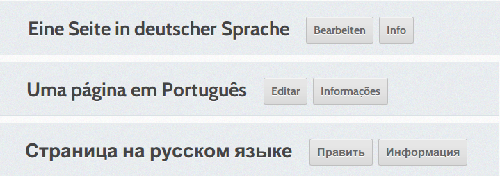
Thanks to the hard work of Pedro Lima and Nuno Maltez in Portugal, LocalWiki is now completely internationalized and can be easily translated into any language!
Pedro and Nuno have started adding to LocalWiki in the city of Porto, Portugal. So far, they've been using LocalWiki to collect information about the remarkable architecture around the city:
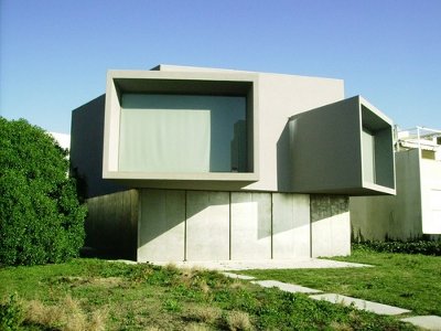 Porto residents are using LocalWiki to document their unique architecture. This is Casa do Cinema Manuel de Oliveira. (Photo c/o Sérgio Barbosa)
Right now we've got translations for Portuguese, German some folks in Sissach, Switzerland), and Russian.
We need lots more translations! If you'd like to help with translations, just email [email protected].
Triangle LocalWiki launches!
We are incredibly excited to announce that our second focus community, the Triangle LocalWiki, launched today! Check it out!
 Reid Serozi and others demoing Triangle LocalWiki at Innovate Raleigh
LocalWiki in the Triangle area launches with over 1000 pages — more than three times the amount that the Davis Wiki had at its launch. Interestingly, the Triangle LocalWiki wasn't spearheaded by college students like the Davis LocalWiki or the Denton LocalWiki. The core group that's driven the buildout of the Triangle LocalWiki met at City Camp Raleigh and is really far reaching — consisting of everyone from, yes, college students to City Council members.
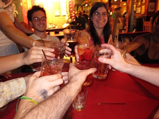
 Celebration!
At over 1000 pages, it can be hard to get a quick feel for the project's breadth. With that in mind, we put together a little random page tour — check it out!
 They even had Triangle Wiki themed champagne!
You can read more about LocalWiki in the Triangle in our post last week and our first year report. And check out this graph of total Triangle LocalWiki content over time:

Our first year
Hey friends!
Whew! A lot's happened since our last blog update! Our first focus community, Denton LocalWiki, has been doing great and several of our other focus communities are close to launching.
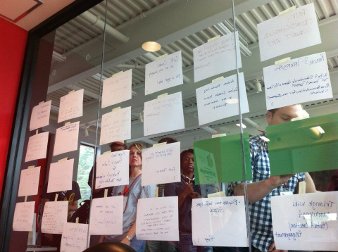
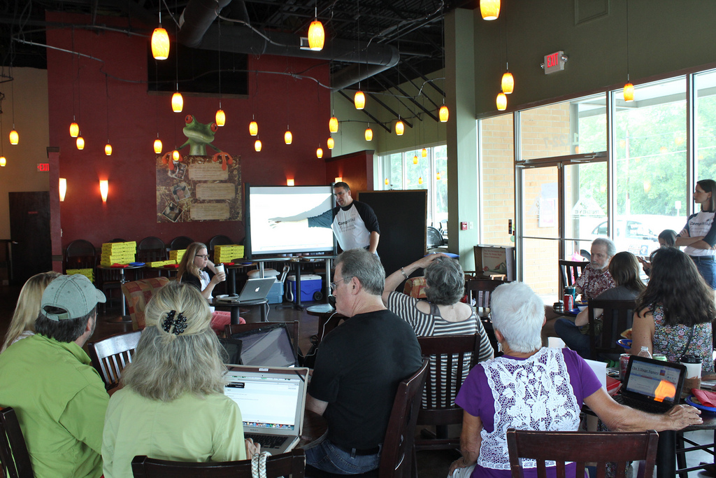
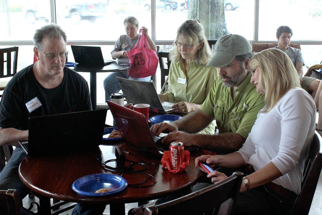
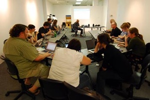
 Around 50 people attended an editing sprint to help Triangle LocalWiki get ready to launch
Just two days ago, nearly 50 people came together in Raleigh, NC to join a massive in person content-building sprint to build up the soon-to-be-launched Triangle LocalWiki. Folks from all walks of life joined in — two City Council members and Raleigh's Chief Planning Director even came by to help out! Read more about the event on our blog.
We thought it'd be great to take some time to look back and reflect on our past year. We've put together this report highlighting some of what we've accomplished and where we're headed:
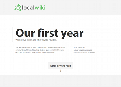
Check it out and share widely!
xo-
Philip & Mike
Triangle LocalWiki Day a Huge Success for Open Source in Raleigh
This blog post originally appeared on southwestraleigh.com, by Jason Hibbets
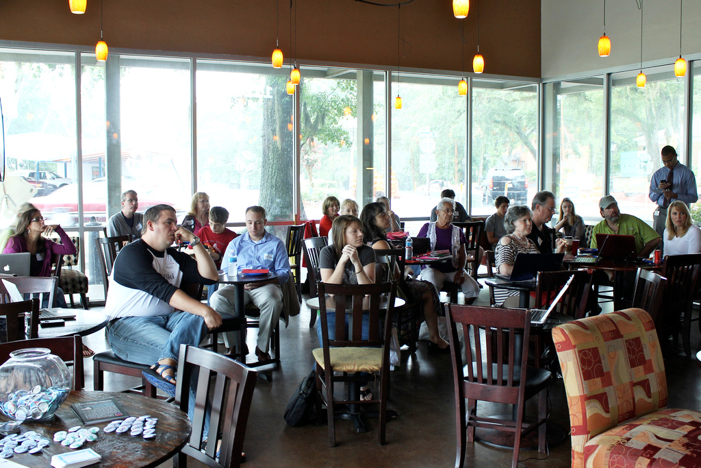
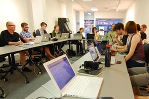
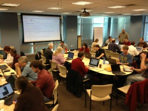
 Almost 50 people collaborated today at Red Hat headquarters, currently located on Centennial Campus in Raleigh, NC, to participate in Triangle LocalWiki Day. The event was a soft launch of Triangle LocalWiki, an effort to document the Triangle region and increase collaboration and knowledge sharing across the area.
The day started off with a brief presentation [PDF] by Jason Hibbets on how the LocalWiki project fits in with the CityCamp Raleigh movement, as well as the larger open government picture and civic innovation week, Code Across America, by Code for America.
Raleigh At-large City Councilor Mary Ann Baldwin keynoted at the event. She spoke briefly on the importance of collaborating on a project like LocalWiki. She also mentioned that she was wearing multiple hats: City Councilor, a marketer, and a member of the Innovate Raleigh steering committee. Part of Triangle LocalWiki Day is to start mapping the assets for the #InnovateRal initiative and to be an authentic part of Raleigh’s open source philosophy and open-minded communities.
At-large City Councilor Russ Stephenson and Raleigh Planning Director, Mitchell Silver, were also in attendance.
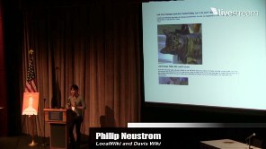
Reid Serozi, Triangle LocalWiki project lead, provided the background on LocalWiki, showing a video from Philip Neustrom, one of the project co-founders of LocalWiki and DavisWiki. Then he walked the attendees through LocalWiki 101. We learned how to register an account, create new pages, and edit existing pages. After that, the edit party began.
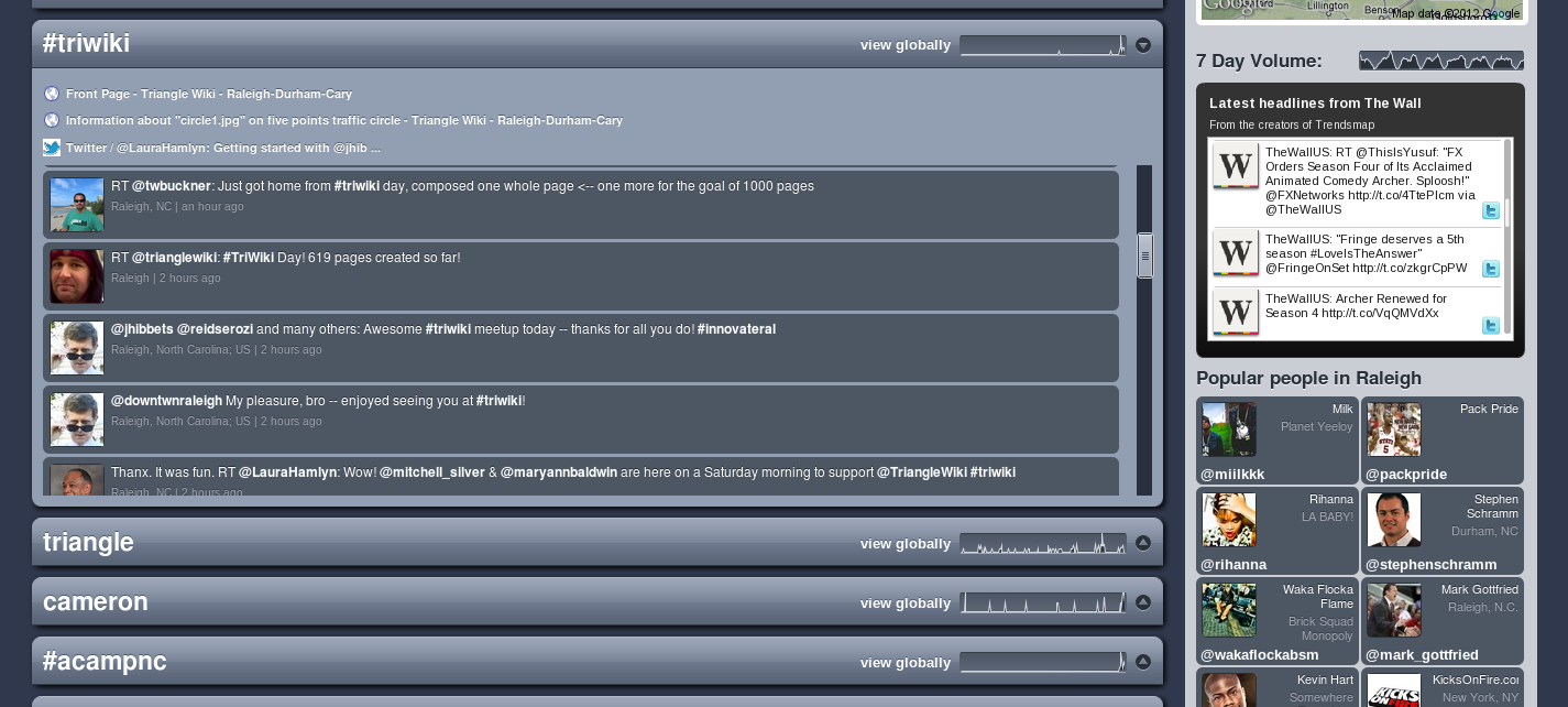 Right away, people started creating pages, collaborating with each other, and helping one another with LocalWiki best practices, formatting, mapping, and more. By 10:30am ET, #triwiki was trending on Twitter in Raleigh.
The group made a lot of progress. Fueled by Klausie’s Pizza for lunch and a bunch of snacks and soda provided by organizers, here are the results of Triangle LocalWiki Day:
- 633 page edits
- 100 maps
- 138 new photos added
The event wrapped up around 2:00 pm and contributors continued to add pages after the in-person collaboration with a goal of 1,000 pages by March 14.
While I haven’t been as-involved with LocalWiki as I was with CityCamp Raleigh, the event was very fulfilling for me. I believe in the power of open source and collaboration and Triangle LocalWiki Day was another example of this success. It’s also building upon the momentum of the Innovate Raleigh Summit held on January 18.
LocalWiki is about creating something anyone with local knowledge can contribute to. It brings together people with different skillsets—ranging from tech-saavy know-how to photography, local history to hackers, and much more. Triangle LocalWiki is basically community knowledge done the open source way.
This work is licensed under a Creative Commons Attribution-ShareAlike 3.0 Unported License.
Pictures
Media coverage (pre-event)
- Creators make final push for Triangle Wiki – News & Observer
- Creators make final push for Triangle Wiki – Public invited to ‘content sprint’ – News & Observer
- Triangle Wiki: Call for Contributors – Cary Citizen
- Triangle Wiki: For those who don’t have time to start a blog, but have something to say – Raleigh DLA
- Something Wiki this way comes, contributors sought – News & Observer
First pilot launches, software released!
Hey friends!
We've got two extremely exciting announcements for you. Our first focus community, serving Denton, Texas, has launched! And we're making the first major release of the new LocalWiki software today!
Launching our first pilot
The Denton LocalWiki, serving the community of Denton, Texas, has officially launched to the public! Check it out!
Denton is a small, college-focused community in North Texas, about an hour from Dallas. Being a college town, it's easy to see parallels to Davis, California. But it's a radically different place than Davis, as anyone who's been to the Dallas area can attest!
Folks in Denton, Texas had been building up and playing around with their project for a few months. With LocalWiki at a good point, and a solid amount of interesting pages on their project, Philip packed up and headed out to Denton for two weeks to help them get their project ready to launch!
We held several marathon editing / hang-out sessions while there, met with lots of local Denonites, got a feel for the community, and did a bunch of work to prep the site for launch.
 A little pre-celebration get-together of DentonWiki folks
The Denton project has already seen a higher level of participation and usage than DavisWiki did in its early days. And we're really seeing our extreme focus on usability pay off -- I watched many non-technical people simply get handed a laptop and just immediately start creating great stuff without any guidance.
If you want to read more about Denton LocalWiki and the launch process there, check out some information we're compiling on our guide site.
This first focus community launch -- the first of many -- is a huge milestone for the project!
Preview LocalWiki software released
Today we are also excited to announce the first preview release of the LocalWiki software! Check it out at localwiki.org!
Make sure you watch the video!
Starting today, any community can create a local wiki using our new software. The software is designed to be installed by someone who's somewhat technical - someone who's had some experience working with Linux, for instance. We worked hard to make the software as easy to install as possible.
Most people will simply use the software, not install it, though. We're hoping that over the coming months many technically-savvy community champions will set up LocalWiki for their communities. The localwiki.org site is currently focused on targetting these sort of technically-minded folks.
There's a list of communities currently running LocalWiki here (and a map here). We'll let you know as more come online, develop, and launch!
There's so much more we have planned for LocalWiki — but this day marks a significant step toward realizing the dream of collaborative, community-run media in every local community.
xo-
Philip & Mike
Texas bound
I'm off to Denton, Texas for a bit to help folks there with the Denton LocalWiki pilot! I'm hoping to meet with / connect-with a bunch of folks, spread the word and generally help them prepare to open up the project to the wider public!
More soon!-
Philip

